Assessing the presence of e-food deserts in the UK
Inequality in access to healthy and affordable food seems to increase when analysing the impact of groceries delivery systems’ availability, especially between remote rural areas and urban areas.
Project overview
Food deserts are areas where residents might experience physical and economic barriers in accessing healthy and affordable food. In addition to these limitations, retailers often fail to provide quality access to groceries delivery systems in certain areas, which we refer to as e-food deserts. The project aimed to provide a clear identification of e-food deserts in the UK, using a unique dataset reflecting online grocery shopping availability at LSOA level.
Data and methods
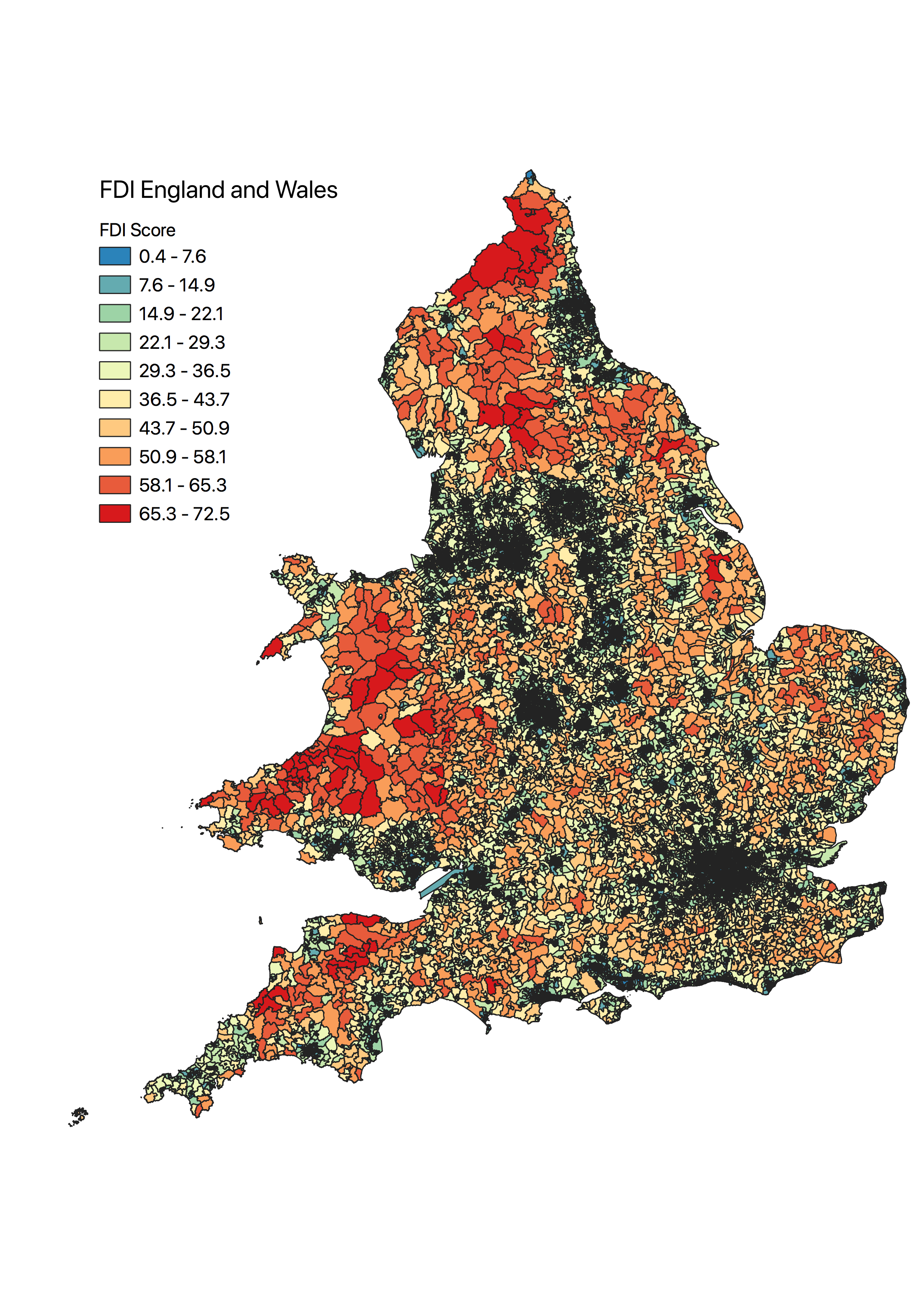
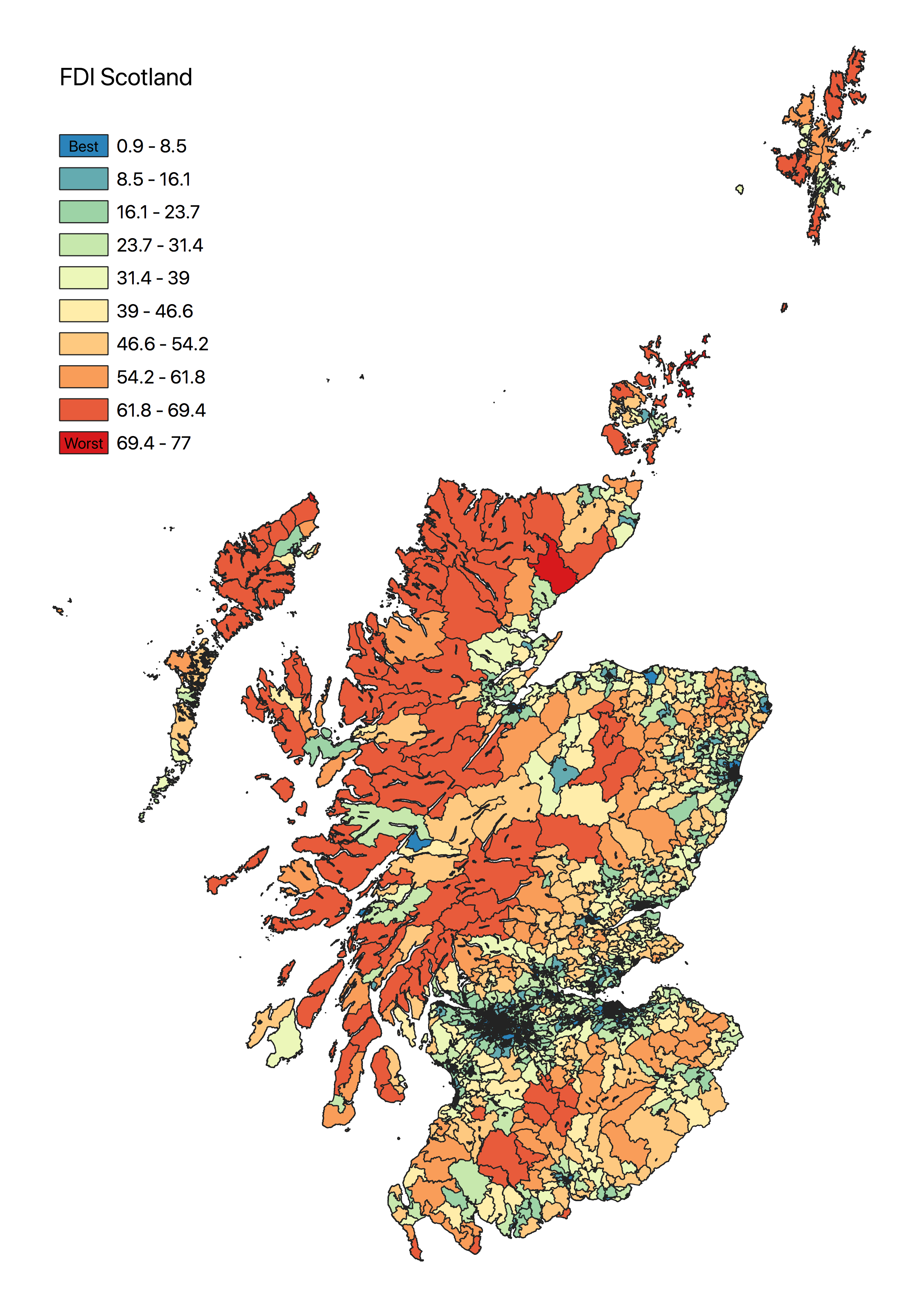
Web-scraping techniques were used to construct a unique dataset capturing the number of major retailers providing online home deliveries at a neighbourhood level across England, Wales and Scotland. To extract a refined measure of consumer accessibility to the retail environment, a Spatial Interaction Model (SIM) was built and calibrated with the help of high-performance computing. Finally, a composite indicator (e-Food Deserts Index) was built using these outputs , ranking every neighbourhood according to indicators measuring access to the retail environment, transport provision, deprivation, resident demographics and, crucially, e-commerce availability.
Key findings
Food deserts are more prevalent in rural areas, when compared to urban centres. Within urban areas, deprivation as low income, no private means of transport, or low-quality public transport, are contributing factors driving the presence of food deserts.
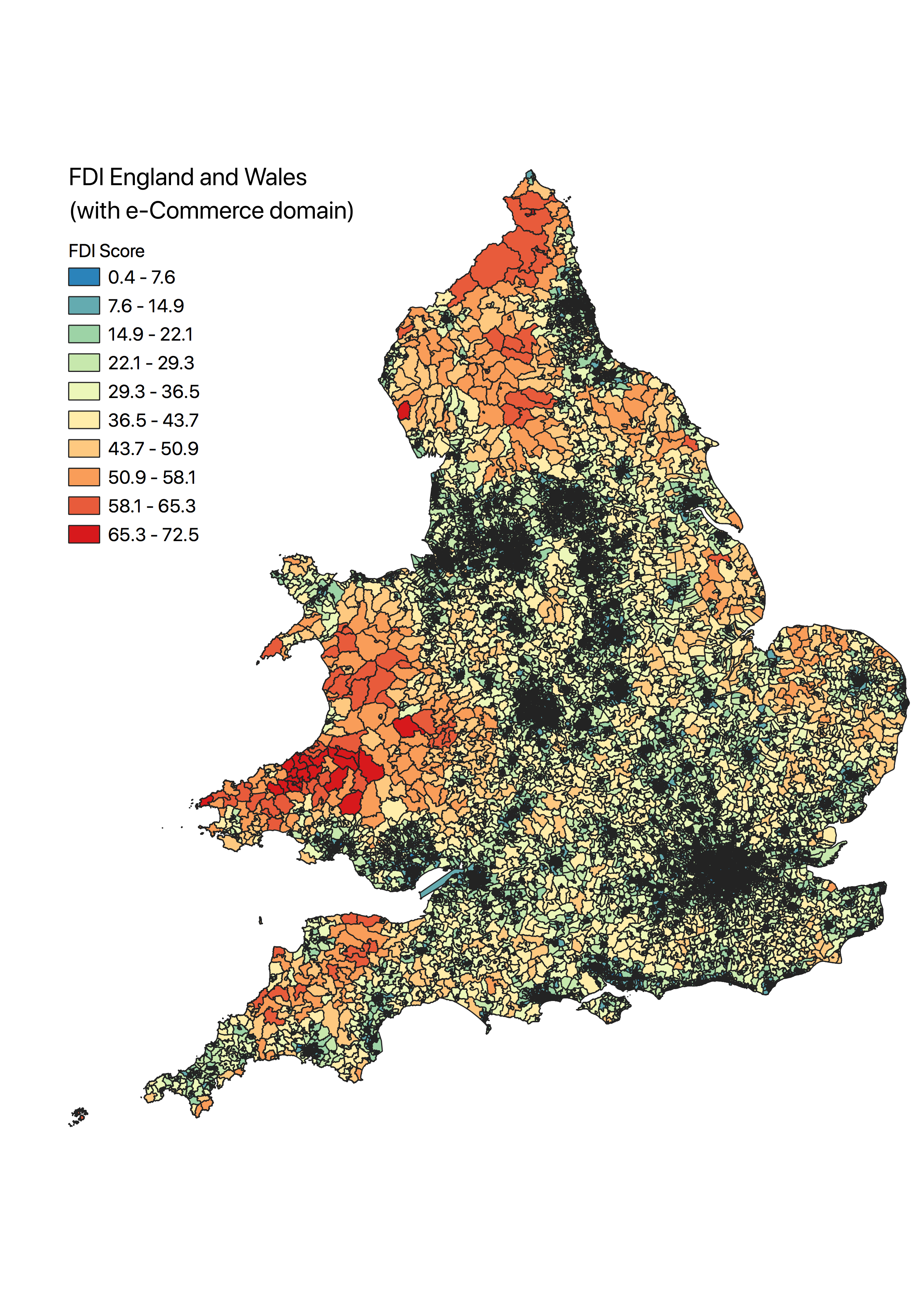
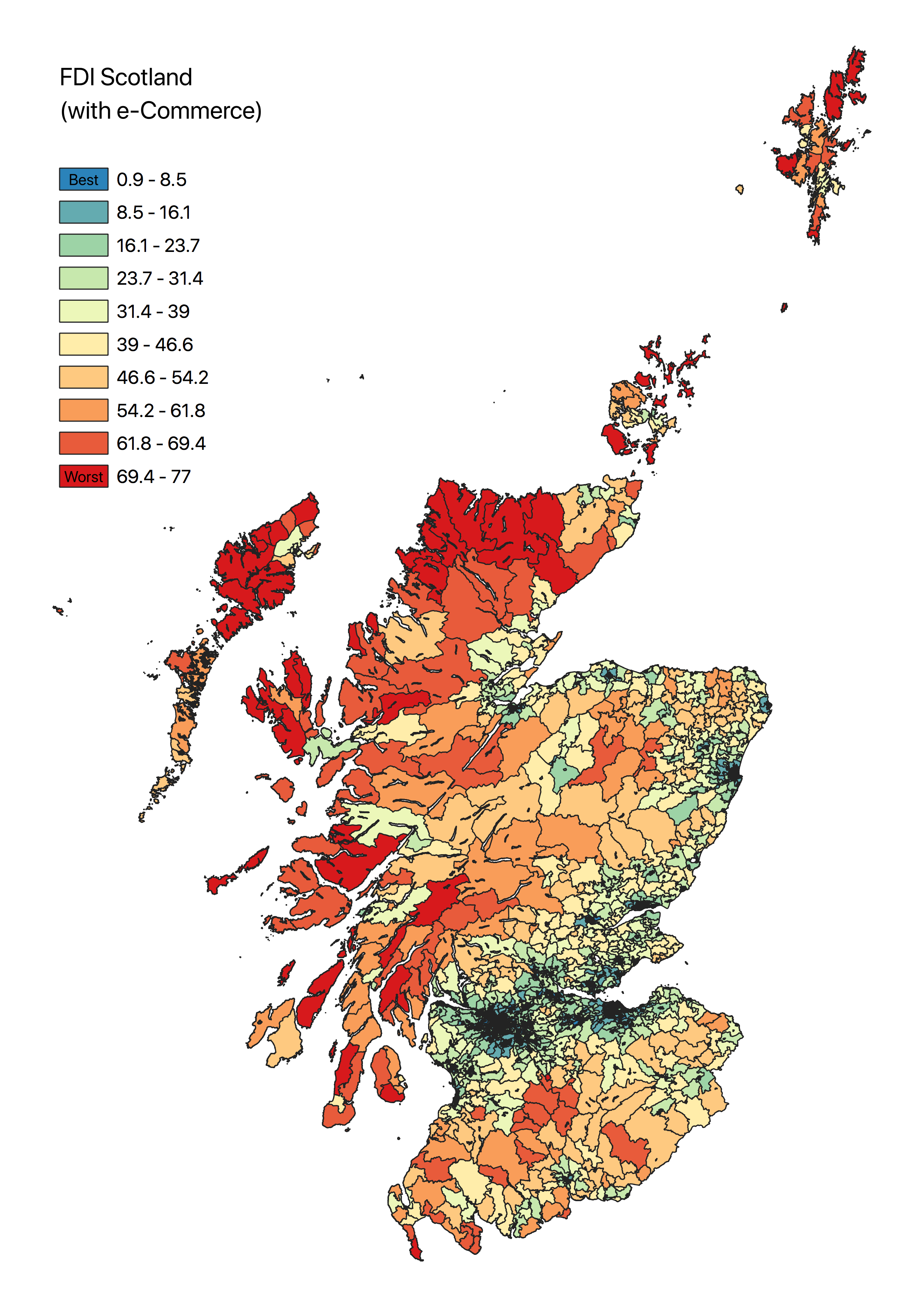
Analysis of the Food Deserts Index shows that the e-commerce domain generates an even greater difference in food affordability and availability between remote rural areas and urban areas. Thus, provision of online groceries delivery, which could considerably improve access within these areas, is actually contributing to a greater urban-rural divide in access to groceries.
The most affected areas in the UK are parts of North and South West England, Mid Wales and Scotland’s Highlands and Islands.
Value of the research
The clear identification of food deserts can provide insight to retailers in their operational planning around home delivery services. Furthermore, this could help local planning authorities in better evaluating local retail provision and assuring equal access to vulnerable populations.
Insights
- Living in a food desert can limit the access to healthy and affordable groceries, impacting the residents’ quality of life
- Vulnerable neighbourhoods usually have low-income households with limited private means of transport and an elderly population
- The groceries e-commerce sector seems to increase the food desert gap between remote rural areas and urban centres
People
This project was conducted by Francisco Videira (Data Science Intern at LIDA) and Dr. Andy Newing (Associate Professor in Applied Spatial Analysis, School of Geography, University of Leeds).
Partners and Funders
Consumer Data Research Centre (CDRC)