Detection of functional commuting zones with complex networks
Ivana Kocánová, Dr Nik Lomax, Prof Nick Malleson - University of Leeds
Using the latest research of complex networks, we uncover inherent community structure within the city of Leeds, improving the understanding of the functional structure of the city.
Project overview
How we structure our cities is essential for resource allocation, but also for understanding social and economic phenomena. However, it is unclear whether the administrative divisions, many of which have been established decades ago, actually take into consideration the real social organization of cities.
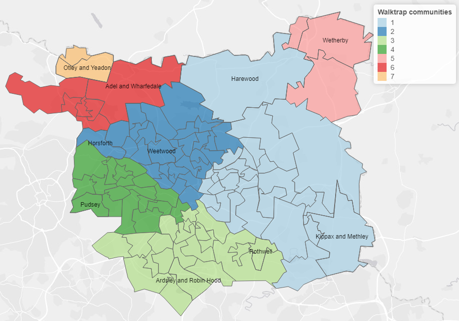
To better understand ever-evolving urban life, this research constructs networks reflecting complex travel-flow data. We identified that Leeds consists of 7 functional commuting areas.
Data and methods
Big geospatial data, recorded by mobile phones, sensors, social media or bike-share are promised to provide a unique insight into the internal spatial organization of cities. In comparison with traditional census data, big data is believed to be richer in information (e.g. temporal patterns) and collected at a higher frequency and at lower costs.
The analysis employs both traditional and new forms of geospatial data recorded by mobile phones to compare the quality of information they provide.
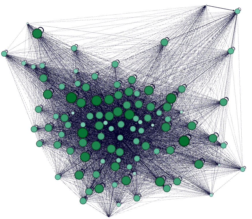
To compute the communities, we have used a random walk-based algorithm called Walktrap. This algorithm tries to find densely connected communities by performing a series of random walks in the network. In theory, a random walker performing a set of steps in the network is very likely to get stuck in the community, as fewer edges are leading outside of these subgraphs.
Key findings
As mentioned before this research utilized datasets generated by two different sources. The first flows were recorded by the 2011 census and the second by a mobile phone provider. The two datasets produced dissimilar networks, despite tracking the same population. The difference was noted both in the connectivity, as well as the topological structure of networks.
In the mobile phone network we identified two large communities, but the low modularity score failed to provide satisfactory validation for the separation. On the other hand, the census network showed a distinct structure that consisted of 7 subgraphs. The higher modularity score served as a validation that these subgraphs would not appear in a randomly wired network.
Value of the research
Being able to identify these communities provides a unique insight into the social organization of Leeds city, improving the understanding of the functional structure of the city. The generation of these regions could be beneficial for urban planning, public transport design and even epidemic outbreak management.
Insights
- Detection of 7 functional commuting zones within Leeds
- Improved the understanding of the functional structure of the city
- Alternative view of urban life
Research theme
- Urban Mobility
- Complex Networks Analysis
- Community detection
This project was undertaken as part of the LIDA Data Scientist Internship Programme.